


2021-09-17 Chemin des hérons

Bernardb44
User
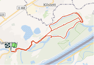

Length
14.6 km

Max alt
140 m

Uphill gradient
93 m
Km-Effort
15.8 km

Min alt
126 m

Downhill gradient
94 m
Boucle
Yes
Creation date :
2021-09-17 13:18:22.06
Updated on :
2021-09-17 17:03:47.984
3h44
Difficulty : Easy

FREE GPS app for hiking
 SityTrail
IGN / Geographical institutes
SityTrail Plus
The world is yours!
About
Trail Walking of 14.6 km to be discovered at Grand Est, Bas-Rhin, La Wantzenau. This trail is proposed by Bernardb44.
Positioning
Country:
France
Region :
Grand Est
Department/Province :
Bas-Rhin
Municipality :
La Wantzenau
Location:
Unknown
Start:(Dec)
Start:(UTM)
413969 ; 5389730 (32U) N.
Comments